-40%
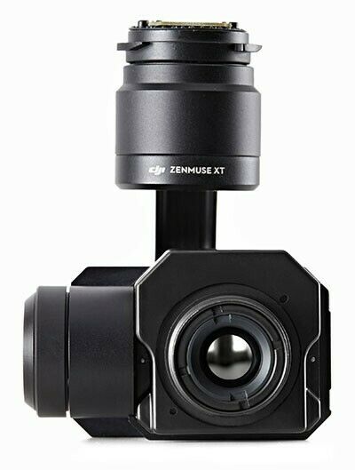
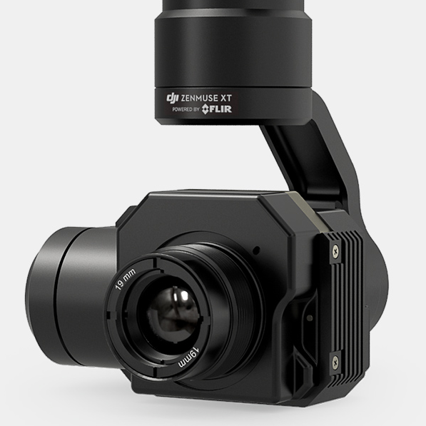
DJI Zenmuse XT 640x512, 30Hz, 13mm, Radiometric
$ 4699.2
- Description
- Size Guide
Description
Thermal imaging from the air has never been as easy as it is with the DJI Zenmuse XT. By combining DJI’s unrivaled expertise in gimbal technology and image transmission with the industry leading thermal imaging technology of FLIR, the Zenmuse XT is the ultimate solution for rapid and reliable aerial thermal imaging. Capture faster, with pinpoint precision, over large areas, then save them for analysis and reporting.INTEGRATED THERMAL CAMERA
The camera on the DJI Zenmuse XT is developed by FLIR. It provides high-sensitivity (50mK) infrared scanning at 640/30 fps or 336/60 fps depending on the camera model. This sensitivity provides accurate temperature measurements ideal for analytics and telemetry. Both cameras are available with four lens options to meet different business needs. Stabilized and controlled by a custom DJI gimbal, it provides smooth, clear imagery and 360 degrees of seamless rotational movement.
FLIR+DJI=POWERFUL AIRBORNE SOLUTIONS
DJI’s Zenmuse gimbal technology has become the industry standard among demanding aerial cinematographers, and everything that makes DJI’s aerial platforms world-class for cinematography also makes them the perfect platforms for aerial thermal imaging: they’re stable, easy to fly, and fully-integrated with apps.
When you get right down to it, the main purpose of any drone is to position a sensor in three-dimensional space; when that sensor is a FLIR thermal imager, you expand the possibilities for drone operators and thermal inspectors alike. Using FLIR thermal imaging from small drones brings new capabilities to dozens of applications like search and rescue, the inspection of power lines, cell towers, bridges, substations, and buildings, firefighting, precision agriculture, and natural resource and wildlife protection.
See the unseen. FLIR cameras reveal details invisible to the naked eye by making subtle differences in temperature visible. This new view on the world can reveal when equipment or buildings are damaged, the location of lost people and much more. Applications like:
Search and rescue
Precision agriculture
Roof inspections
Power line inspections
Firefighting
Substation inspections
Cell tower inspections
Security
Surveying
And anything else you can dream up
IMAGE ENHANCEMENT SOFTWARE
Infra-red imagery requires optimization to ensure maximum definition for capturing information. The Zenmuse XT features a suite of image enhancements designed by FLIR including Digital Detail Enhancement™ (DDE); Smart Scene Optimization™ (SSO), which enhances extremes in bi-modal scenes; Active Contrast Enhancement™ (ACE) that adjusts scene contrast relative to its temperature difference; and Information Based HEQ™ (IBHEQ) which compresses complex image data to create the best quality image.
FINGERTIP CONTROL
The Zenmuse XT can be controlled completely through the DJI GO app, providing a real-time, low latency view of what the camera sees, and instant access to core camera functions including:
Spot metering, temperature measurement at the mid-point
Digital zoom
Single or interval shooting modes
Photo, video preview and download
Take photos while recording video
Various camera settings and parameters including:
- Palette, also referred to as Look-up Table (LUT)
- Scene, also referred to as Automatic Gain Correction (AGC)
- Region of Interest (ROI)
- Isotherm mode
MISSION READY
Mounted on either the Inspire 1 or the Matrice 100, the Zenmuse XT is ready to launch in seconds. Its seamless integration gives you access to important features like DJI’s powerful Lightbridge video transmission system, automated Point of Interest, Course and Home Lock, Follow Me, and the DJI SDK.
Fast, efficient, yet stable airframes, the Inspire 1 will keep the Zenmuse XT aloft for 22 minutes. If used with the Matrice 100, the Zenmuse XT can stay in flight for up to 35 minutes*, ideal for large scale inspections and especially useful in search and rescue scenarios.
*Inspire 1: Flight times vary based on flight conditions, with a maximum 22 minute flight time being recorded when hovering with a TB48 battery using the Zenmuse XT gimbal camera.
*M100: Flight times vary based on payload and flight conditions, with a maximum 35 minute flight time being recorded when hovering with dual TB48D batteries and no additional payload other than a Zenmuse XT gimbal camera.
Field of View
6.8/7.5mm
9mm
13mm
19mm
640 x 512
90 degrees
69 degrees
45 degrees
32 degrees
336 x 256
45 degrees
35 degrees
25 degrees
17 degrees
